
Another hurricane is headed our way expected to batter our coastline with intense wind and rains, and waves of 3-5 meters.
The Secretary General of the Government, Master Enrique Ibarra Pedroza, led a working meeting in order to review the agreements and maintain inter-institutional coordination in the face of the arrival of tropical storm “Nora” to the coast of our state. The Director of the State Unit for Civil Protection and Firefighters of the State of Jalisco, Víctor Hugo Roldán and the meteorologist of the National Water Commission, the Lerma River Basin Santiago Pacífico Gerardo Vázquez, also participated in the work table.
During the meeting that was held in person and virtually with authorities representing the three levels of government and municipal presidents, it was reported on the operation and prevention actions that will be carried out in order to safeguard the well-being of all citizens who may be affected after the passage of this phenomenon.
Such is the case of CONAGUA, who began working early this Friday to vent dams in the state such as Tacotan and Trigomil serving Unión de Tula, and Cajón de Peña serving Tomatlán.
Among these actions the Security Secretariat deployed elements of the regional commands, the Ministry of Health has the advanced medical post ready to be used in case of requiring emergency medical attention, and Jalisco Civil Protection also deployed 60 elements of the municipal commands to support the population, as well as the intensification of the surveillance in the following municipalities that could be violated by the passage of "Nora":
Cihuatlan
The Huerta
Tomatlan
Cape Corrientes
Vallarta Port
Talpa de Allende
Villa Purification
Casimiro Castillo
Cuautitlán de García Barragán
San Sebastian del Oeste
Mascot
Atenguillo
Cuautla
Ayutla
Autlán de Navarro
Tuxcacuesco
Toliman
Tecalitlán
Tuxpan de Bolaños
Zapotlán the Great
Zapotitlán de Vadillo
Jilotlán de los Dolores
Pihuamo
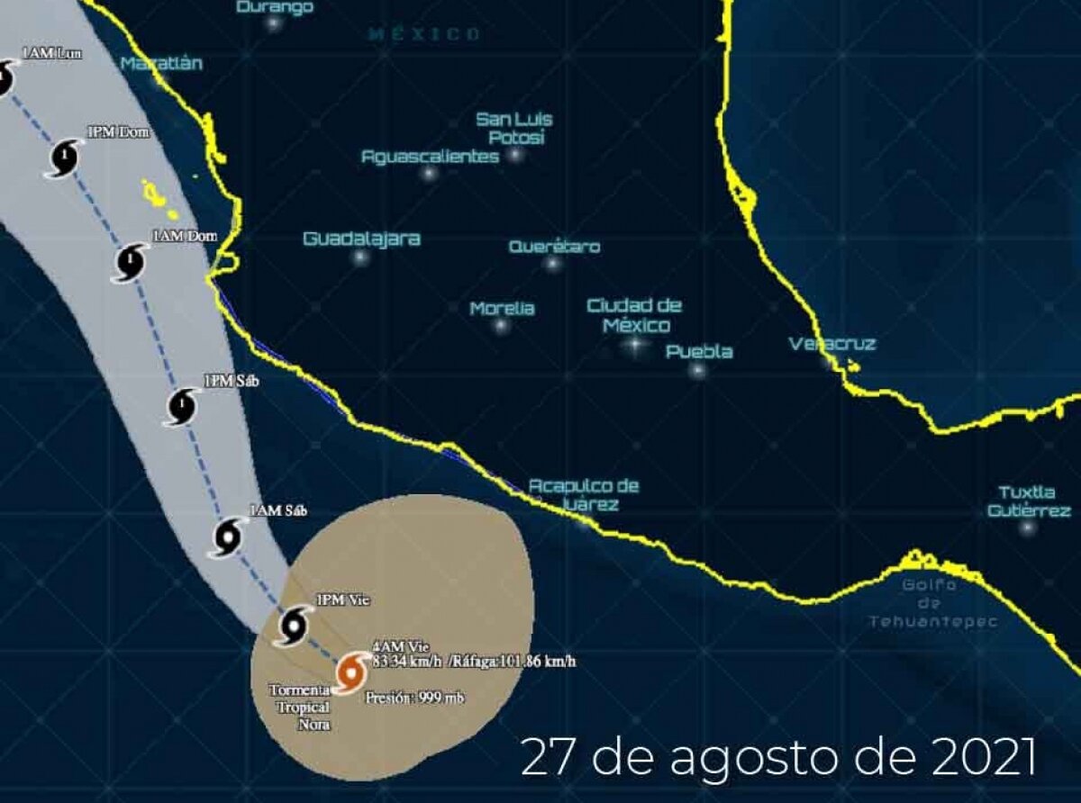
It should be noted that at 4:15pm this afternoon “Nora ”was located 395 km south of Manzanillo, and 975 south south-southeast of Cabo San Lucas, inclining its displacement towards the Northwest at a speed of 19 km/h. With sustained winds of 100 km/h and gusts of 120 km/h, the hydrological phenomenon is expected to intensify to a category 1 hurricane as of Saturday, very close to the coasts of Jalisco and Nayarit. This could cause moderate to heavy rains all over Jalisco and into the metropolitan area of Guadalajara, while in the coastal areas intense to torrential rains, in addition to waves of 3 to 5 meters and sustained winds of up to 80 to 100 km/h with gusts that could exceed 120 km/h.
The State Government, through the State Unit for Civil Protection and Firefighters, urges the population to stay informed through official channels.
conagua.gob meteorological site